



2026 pilot programme · Occitanie, France
Every parcel, row by row, on one record.
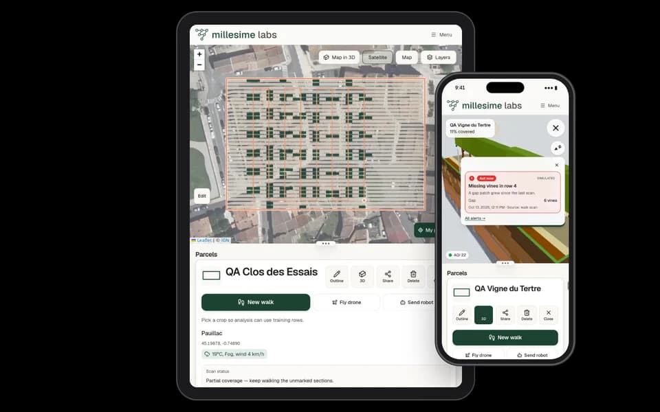
Walk your rows with your phone. Millesime shows what you have covered, keeps the photos where you took them, and flags what needs a second look.
Already have an account? Open the app
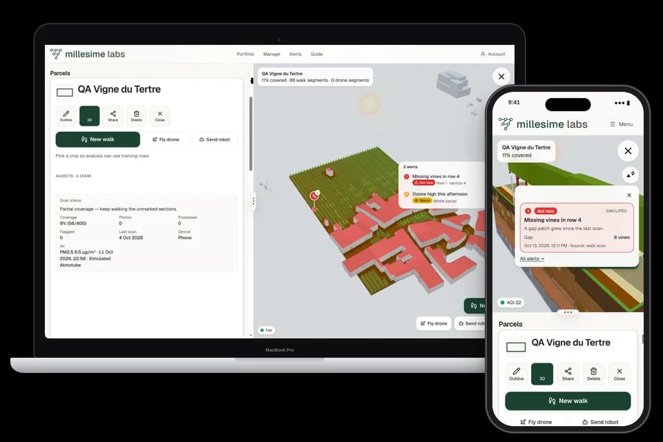
- Built in Montpellier, for vineyards and Mediterranean crops
- Runs on your phone, no mandatory hardware
- No signal between the rows? Photos upload once you're back
The product
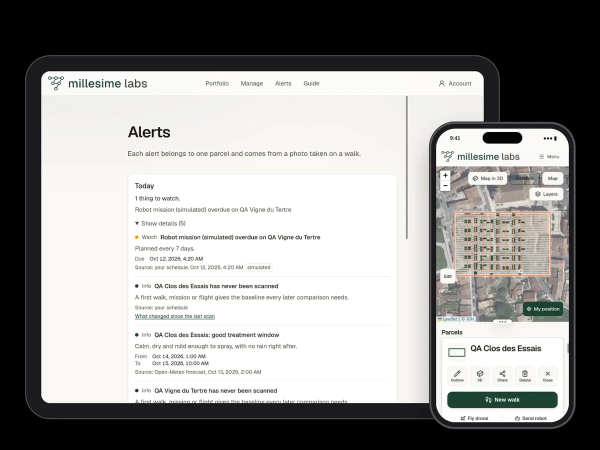
What you see, parcel by parcel.
Coverage
Pale strips along the rows are vines the camera has not seen yet.
Alerts
Every alert is tied to its parcel and to the photo that raised it.
History
The history strip lists the walks, with the date and the device. Pick a moment and the map draws the surface, the row sections, and the path as they were then. A day with several walks offers earlier and later that day.
Air quality
With an Atmotube PRO 2 sensor, particle readings land straight on the map.
How it works
Three steps, one up-to-date record.
01
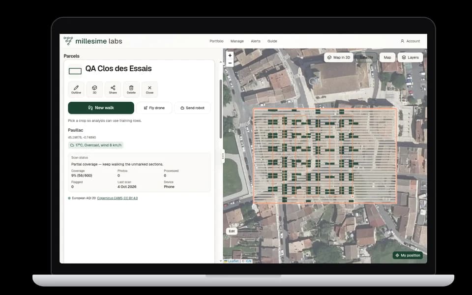
Outline the parcel
Zoom in on the map: the land-registry outline appears, and you keep it or redraw it in seconds.
02
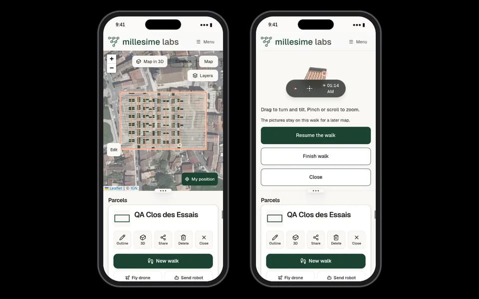
Walk your round
Walk the rows with your phone. Millesime shows what's left to cover and takes photos in the right places.
03
Find it all again
Crop, variety, photos, alerts and history stay on the parcel record, ready to review or share.
The problem
The field changes faster than the notebook.
- 01
Field rounds happen on foot, and what you saw gets written down from memory, in the evening, if at all.
- 02
Observations end up scattered: photos on the phone, messages, a notebook in a back pocket.
- 03
From one season to the next, it's hard to tell where you walked and what really changed on a parcel.
Roadmap
We start with the phone. The rest will follow.
- Available
The field app
Outlines, walks, photos, alerts and history on phone and desktop. Works with the DJI Mini 4 Pro to fly over a parcel.
- In pilot
The atmospheric sensor
Air readings taken in the field and linked to the parcel. We're testing with the Atmotube PRO 2 today.
- Later
Robotics
A robot or drone that walks the round for you. The natural next step, with no date announced.
Pilot programme
We're looking for ten farms to build this with us.
You use Millesime on your parcels for one season. We come to you, we listen, and the product evolves with your feedback.
To be clear: Millesime Labs is a young company based in Montpellier. No customers to show off or numbers to boast about yet. Our first references will be our pilot farms.
- On-site setup with your first parcels
- A direct line to the founder
- Your feedback decides what gets built next
- No commitment beyond the pilot season
FAQ
Before you start.
Do I need to buy hardware?
No. The app runs on your phone. The air sensor and the drone are optional.
What if there's no signal in the rows?
Photos wait on the phone and upload in order as soon as the connection is back.
Which crops?
Vines first. Maize, wheat and grassland are already supported, with a walking interval suited to each crop.
Who owns my data?
You do. It's used to run your parcel records and nothing else.
How do I join the pilot?
Write to us from the contact page with your farm's name and town. We'll call you back to plan a first visit.
Latest notes
Ready to see your parcels differently?
One visit is enough to outline your parcels and walk a first round together.